We can't always appreciate the beauty of our Earth's landscape from a ground perspective. However, from up in the air, the spectacular scenes are breathtaking. On a daily basis, The European Space Agency posts satellite images of our surroundings from an outer space perspective.
Cartographers and mapping experts may instantly be able to identify streets, buildings, and land formations, but to the rest of us, the images resemble well-composed paintings filled with rich, vibrant colors. City grids are transformed into geometric patterns, magnificent mountains and valleys materialize as tangible textures, and swirling blue seas become abstract painterly strokes along a canvas.
As entire cities consume just inches of a composition and massive bodies of water appear to be endless, not only do the images provide a unique glimpse of our planet, but they also serve as a reminder of just how small we really are here on Earth.
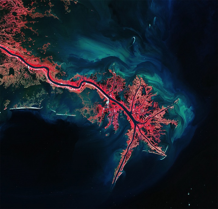
Mississippi River Delta, October 3, 2011
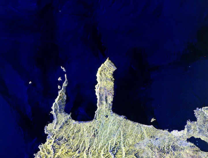
Northwestern Crete, compilation of images taken August 28 and October 13, 2010
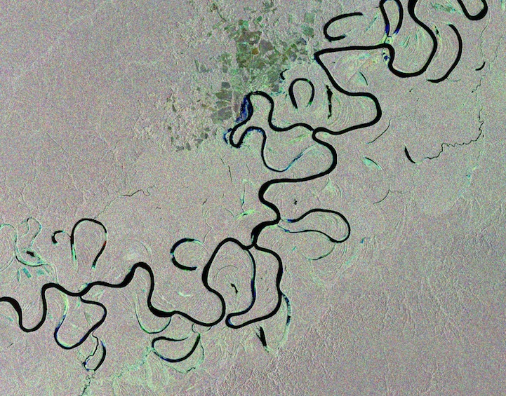
Rainforest river, Brazil, compilation of images captured on January 2, February 1 and March 3, 2012
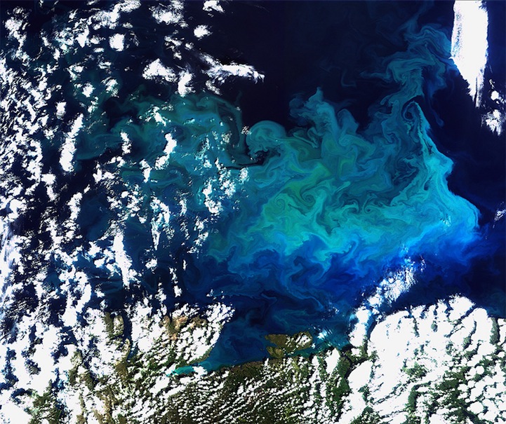
Plentiful plankton, August 19, 2009
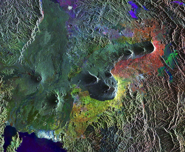
Virunga Mountains, compilation of images taken March 27 2003, January 5, 2006 and August 12, 2010

Ganges' dazzling delta, compilation of images taken January 20, February 24, and March 31, 2009
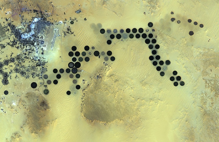
Libya's Al Jawf oasis, January 24, 2011
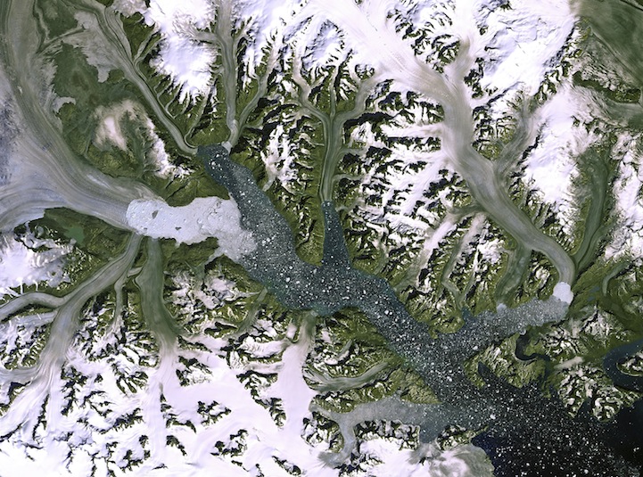
Kangerdlugssuaq glacier, Greenland, September 19, 2012
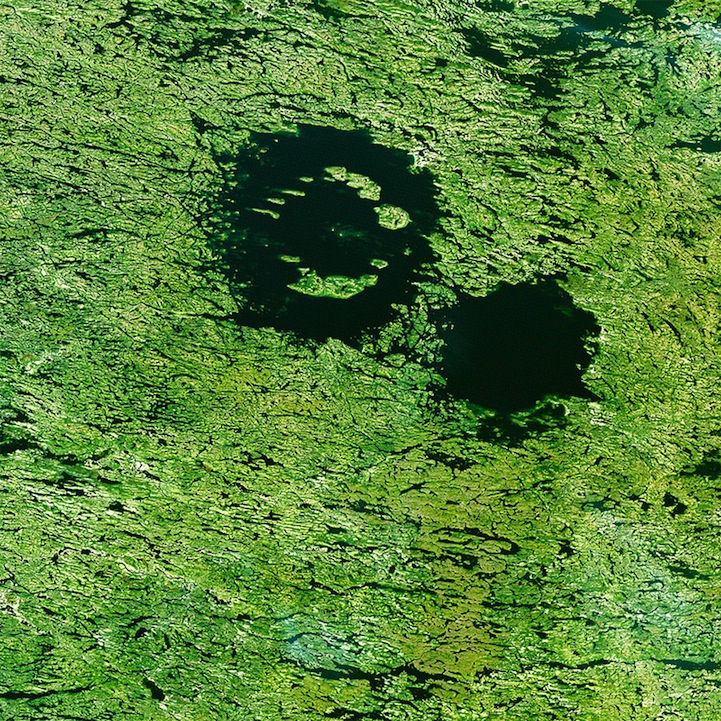
Clearwater Lakes, Canada, September 9, 2010
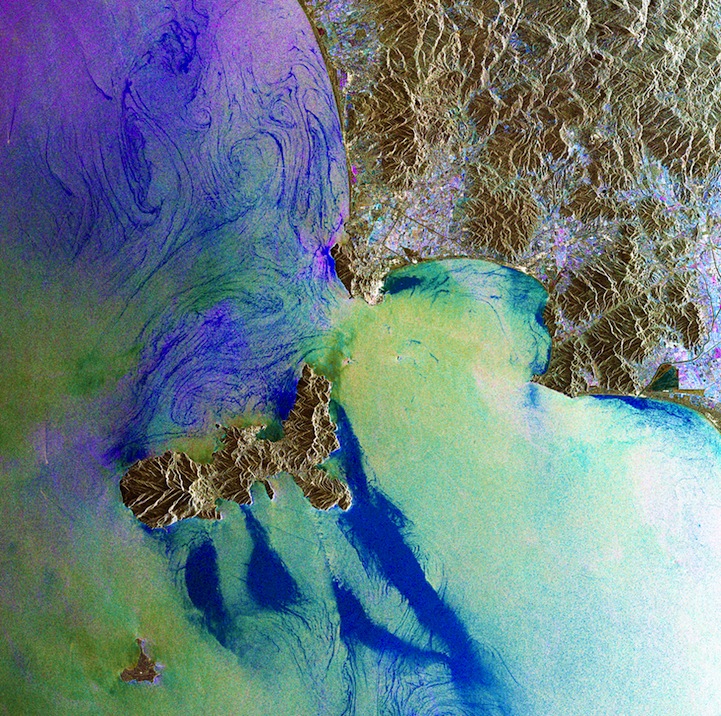
The Island of Elba, Italy, compilation of images taken November 29, 2008, February 7, 2009 and August 21, 2010
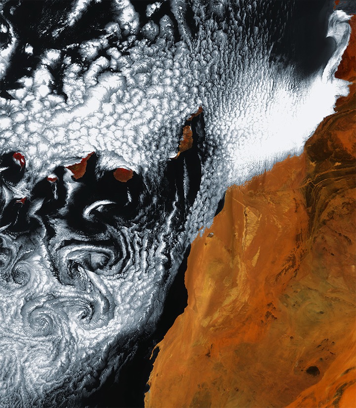
Swirling cloud art in the Atlantic Ocean, June 6, 2010
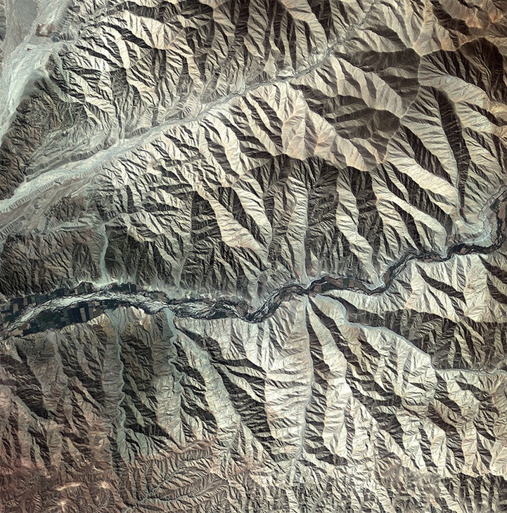
Peruvian landscape, May 4, 2011